


 My blog
  Support me on Tipeee!


Saturday11June
The church of Reykjahlíð is still there! So everything is fine! We can resume our exploration of the Mývatn site!

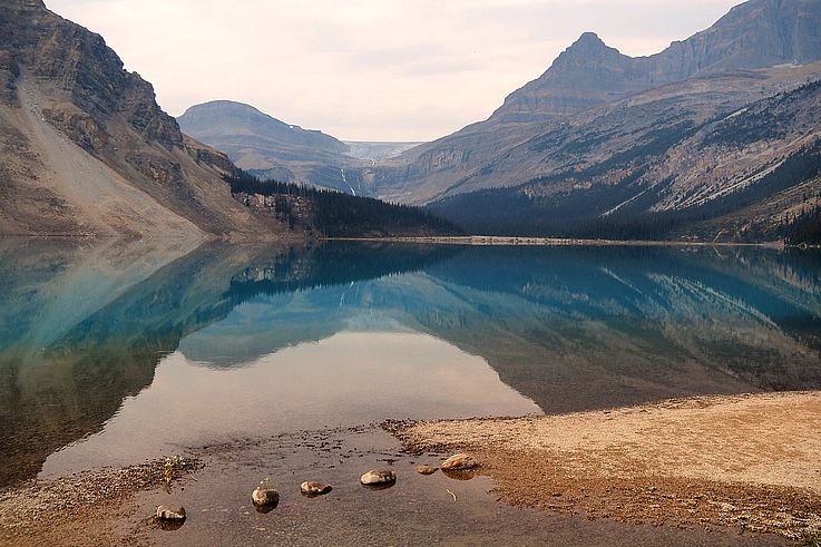
In the background, Mount Blafjall
Krafla Landsvirkjun
This geothermal power plant is managed by the Icelandic national electricity company Landsvirkjun. It uses naturally hot underground water to produce electricity for the entire eastern region of Iceland.


Leirhnjúkur
Here we enter the caldera of the Krafla volcano. Still fuming, Leirhnjúkur plunges us into the first moments of our planet's life, at least we really believe it!


A weather balloon on a stroll in the Icelandic sky

The short visit to the site begins with this pretty orange hill that hides the black magmatic plain of Krafla.


Here we are, crossing the lava field left by Krafla's last eruption in 1984. The warm ground and the fumaroles scattered around us betray the nearby presence of the magma chamber. Indeed, it is only 2 kilometers beneath our feet, which is tiny on a planetary scale.


The lava flow solidified into basaltic rock


Vegetation slowly reclaims its place


The Viti crater
The walk continues with the Viti crater and its 300-meter-wide lake, colored by the magnificent sky accompanying us today (The blue of the lake is actually colored by siliceous algae) 


Igloos are right next to the crater, just to sow doubt about the presence of Martian astronauts in the vicinity.... 


algae or elven hair??? 


And that's two! After Hverfjall, Viti also gets its snowman!


Jarðböðin við Mývatn
These are the Mývatn Nature Baths (the local small Blue Lagoon, in reference to the much larger one in Reykjavik). In the middle of this lunar landscape, we treat ourselves to a moment of relaxation in these naturally warm blue waters, approaching 35° or 40° depending on the basin. Fortunately, the slightly sulphurous smell of the water reminds us of the surprising place we are in!


The Bjarnarflag geothermal power plant, historically the first in the country!


The Grjótagjá caves
Located right at a large fault line, the Grjótagjá caves plunge us into darkness. It's the camera that reveals the blue of the water. Siliceous algae surely benefit from the water's heat, which is around 50 degrees.


We climb above the cave where the Grjótagjá fault reveals itself to us with the Hliðarfjall mountain in the line of sight.


This fault is the result of the separation of the Eurasian and North American plates! And yes, we are on the Mid-Atlantic Ridge and beneath our feet, plate tectonics is renewing the Earth's crust at a rate of 2 or 3 centimeters per year... 

Would a single small jump be enough to take us from Europe to America?


Right next door, another cave with an orange ceiling


And there we go, we're back on the road, leaving the Mývatn region to reach the town of Húsavík on the north coast, about sixty kilometers away.


A quick photo break to capture the desert expanse that must be crossed to reach northern Iceland

Come on! A little gastronomic photo of dinner, that'll be a change from rocks and stones!


Latest comments
On Guatemala 2018
Le 25 Novembre 2024
Significado de este mural
On Chile 2016
Le 15 Septembre 2024
Rrrrrr
On Egypt 2003
Le 1er Avril 2023
Et oui c'est bien nous aux pieds de ce Colosse !
Le 1er Avril 2023
Bien petits aux pieds de ce Colosse !
On Namibia 2014
Le 3 Août 2021
very good indeed