


 My blog
  Support me on Tipeee!


Saturday12November
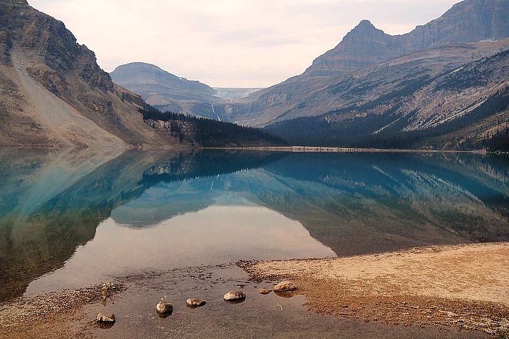
Santiago from the plane
We will soon be landing in Santiago after a 3-hour flight from Punta Arenas. In the background, the snow-capped peaks of the Andes Mountains...


Then we take off again after a 2-hour wait to fly over the Pacific for 5 hours and reach Easter Island!
Easter Island from the plane
And here we are, almost 4000 km from Santiago, above the tiny Easter Island, which can be seen entirely through the plane's window. Rapa Nui (the local name of the island) is only about twenty kilometers wide!


Mataveri Airport
Mataveri Airport where you disembark directly onto the tarmac. The runway is one of the longest in the world. In 1986, the Americans extended the runway so it could receive the space shuttle in case of a problem...


By the time we collected our luggage, the manager of the campsite where we're staying greeted us by obviously putting a flower necklace around our necks!  Here, the influence is much more Polynesian than Chilean!
Mihinoa Campsite
The island's main campsite is a few meters from the ocean. No need to bring your tent and sleeping bag as they are provided.


The weather is glorious and we'll finally be able to enjoy our shorts and short sleeves! After two weeks of braving Patagonia's grey weather, this will do us good! 


A short late-afternoon stroll through the main street of the island's only town, Hanga Roa. We're used to it by now; we once again come across a sign indicating the route to follow in case of a tsunami...

The "bare" hills, devoid of any trees, on Easter Island. The island is indeed known for this, but since then, forests have been replanted.


A plane lands. They won't bother us because there are few of them. Only 2 airports serve the island: Santiago, Chile, and Papeete (Tahiti).

Pea Beach
At the bottom of Hanga Roa, a few meters of beach allow swimming, sheltered from large waves by a breakwater. So I take a dip, but not for long, as this Pacific is quite cold! On the other side of the breakwater, however, surfers are having a blast on their boards. So am I, with my camera! 


Wind rose signs indicate, in nautical miles, the distances from the island to major cities. San Francisco 7090 nm (13130 km), Honolulu 3969 nm (7350 km), Marseille 8684 nm (16082 km), Hong Kong 9702 nm (17968 km)... Apparently, this is not the shortest way! 


Back in front of the campsite, where the sun turns the ocean's wild waves blue...


And quickly, the sunset arrives with its share of lovers...


A few steps from our tent, two (fake) Moai stand guard. Tomorrow, we'll go see some of the originals...


Frugal meal with a "hot-dog" empanada...

Then a small astronomical session with Venus, which will also soon set...


Sunday13November
Breakfast in the large campsite kitchen. Each tent has its locker with the essentials for eating (cutlery, glasses, and plates). Pots and pans are available to everyone, with each person responsible for washing their own dishes.

Santa Cruz Church of Hanga Roa
We happen to pass by the church in Hanga Roa. It's perfect timing, it's Sunday and mass is just ending!


The priest (Bernardo Astudillo Basulto) blesses a few tourists. And apparently, the Vatican has authorized a clever blend of Polynesian Rapanui Catholicism!


The interior of the church.


The statues present here are very "nature-inspired".


A statue of what appears to be a Make-make, the bird-man, the God of the island before it was colonized by Europeans...


Te Pito o Te Henua street in front of the church.

Ahu Tahai Cemetery of Hanga Roa
We return to the coast north of the town to get closer to the Ahu Tahai site where we can see our first "real" Moai. The site is near the very simple but nevertheless very beautiful cemetery of the island. In this small square, wild nature seems completely tamed, unless it's the other way around...


These horses have noticed it too; this white sailboat adds its little "postcard" touch to the already very photogenic landscape...


Ahu Tahai
And precisely, more than this sailboat, it is these statues that catch our eye... The Moai of Ahu Tahai are aligned with their backs to the ocean. Another, a little apart, also looks towards the center of the island...


Before reaching the statues, a plaque commemorates one of the archaeologists who did much for the preservation of the island: William Mulloy. He was buried here in 1978.


Here we are facing the 5 Moai, or at least what remains of them.

The statues are placed on a ceremonial stone platform, called Ahu. They were placed here a few centuries ago. All the Moai on the island were built between the 13th and 16th centuries.

The two statues still intact on their Ahu.


Two Moai are set back. The first, named Ko Te Riku, wears a "pukao" on his head, representing not a hat but a topknot-shaped headdress. The second, Ahu Tahai, is the oldest on the island; legend has it that this is where the first Rapanui inhabitants landed.


"Ko Te Riku" is the only Moai with drawn eyes. They are made of white coral, and the pupil is of the same red stone that forms its headdress.


It's not good to be here in case of an alert...


A little higher up, another isolated Moai, Hanga Kio'e.


Each site has its explanatory sign.

Returning to the village, we pass by other local works, but much more modern ones.


The small port of Playa Pea.


The Moai Hanga Piko sits in the port.


We pass again in front of the compass rose and its indications in nautical miles. Valparaiso, where we were at the beginning of the trip, is thus one of the closest cities to Hanga Roa, 3611 kilometers from here...


We head south of the island where the Rano Kau volcano is located.


Pacific frigatebird (Fregata minor). It's a female because the male has a red gular pouch under its throat.
Passage through the Ana Kai Tangata cave where rock paintings representing birds, animals highly revered at the time, are visible.


To the left of the entrance, one can make out the pink-orange pastel paintings of birds...

Another cave, invaded by waves, under the Iorana hotel.


The Rano Kau volcano
We finally arrive at the foot of the Rano Kau volcano. All that remains is to climb the slopes of the mountain following the pedestrian path that crosses a small wood.

And quickly, we reach the very top, at the edge of the magnificent crater.


Rano Kau is an effusive type volcano (as opposed to explosive), meaning that during an eruption, lava spreads slowly over the volcano's slopes. But rest assured, it has not been active since its last eruption dating back at least 100,000 years... The dome has since collapsed, leaving this perfect crater a kilometer in diameter...

The steep walls of the volcano culminate at 300 or 400 meters in height.

The bottom of the crater now hosts a multitude of small ponds or islets of rushes (Scirpus tatora).


In the distance, we can make out the tents of our campsite!

We begin the walk on the top of the crater by the East side. On the other side of the crater, opposite us, are the ruins of the village of Orongo.

We are not the only ones enjoying the view! A cow peacefully grazes the grasses of this ex-volcanic meadow...


We reach the end of what can be explored. A part of the crater has collapsed into the ocean, preventing a complete loop in complete safety. In the ocean, 3 small islands watch over Rano Kau: from left to right, Motu Nui, Motu Iti and Motu Kao Kao...


According to the old religious beliefs of the island, it was on these islets that the Rapanui people were born. The creator God Make-Make came here to lay an egg that gave birth to the men and women of the island... Later, and until the end of the 19th century, this resulted in a competition between the different tribes. Each of them nominated the bravest representative. They had to leave the ceremonial village of Orongo at the top of the volcano and swim to the islets to find a sacred egg of "Motu Nui" (probably frigatebirds then terns). Once found, the egg had to be brought back by the same path, climbing the 300 meters of cliff at the same time... The winner was named "Bird-Man" (Tangata manu) and then occupied a position of primary importance on the island.

We therefore retrace our steps (without an egg, of course) to reach the other side of the collapsed slope where the village of Orongo is located.


The volcano, a perfect place for a dog's Sunday walk...


Last glance at the blue channels that skirt the small islets at the bottom of the crater and we arrive at the end of the route in the village of Orongo... Alas, we have to postpone the visit until tomorrow because the site closes at 5:30 p.m.!... Well, never mind, we'll come back tomorrow!


Second night at Mihinoa campsite where the two cement moais face my camera, which is trying its best to capture the planet Venus on its veiled sky...


Monday14November
This new Easter day will not be pedestrian but "quadestrian"! We rent this quad (for lack of a scooter which was no longer available) to easily access the different tourist sites.

Orongo
As promised, we return to the top of the Rano Kau volcano (by quad, therefore) to visit the ruins of the ceremonial village of Orongo.

The islands that the future bird-man had to reach...


The low basalt stone houses. The places were occupied only during the Bird-Man ceremonies from July to September. With the arrival of missionaries in 1866, the ceremonies were forbidden...


The village paths run along the edge of the crater.


At the very end, rocks are covered with petroglyphs, mostly representing the bird-man. Alas, one cannot approach the drawings, so it is difficult to recognize the petroglyphs without a guide.


One of the petroglyphs found online. In the photo, only the beak on the central rock is visible... It represents the bird-man: a man's body, a large eye, and a hooked beak (like frigatebirds).


We take the quad again to reach the most famous Moais on the sites of Rano Raraku and Ahu Tongariki.
Latest comments
On Guatemala 2018
Le 25 Novembre 2024
Significado de este mural
On Chile 2016
Le 15 Septembre 2024
Rrrrrr
On Egypt 2003
Le 1er Avril 2023
Et oui c'est bien nous aux pieds de ce Colosse !
Le 1er Avril 2023
Bien petits aux pieds de ce Colosse !
On Namibia 2014
Le 3 Août 2021
very good indeed